Transnavicom Satellite Map of Zurich 1.0
You can get acquainted with a district of Zurich; the following basic functions
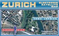
Demo-version of Satellite Map of Zurich! The newest developments and progressive experience of Transnavi.com give a chance to create such high-quality and unique products! Satellite technologies are available to everybody!
Software Specs
Publisher:............ Transnavicom LTD
License:............... Demo
File size:.............. 18.76 MB
Downloads:.........
Release date:...... 10 Jan 2007
Last update:........ 21 Dec 2011
Language:............ English, German, Russian
Publisher review for Transnavicom Satellite Map of Zurich 1.0:
Review by: Transnavicom LTD
Demo-version of Satellite Map of Zurich! The newest developments and progressive experience of Transnavicom (www.transnavi.com), professionalism of our specialists, aspiration and wish to do our favourite thing give us a chance to create such high-quality and unique products! Face the reality! Your dreams are coming true with satellite maps from Transnavi.com. In the demo-version you can get acquainted with a district of Zurich, use address-search functions and measure the distance between any number of points!
Basic properties of the programme demo-version:
Spatial resolution - 60 centimeters in one pixel allows to have a detailed look at buildings, smallest curves of streets, cars on the streets, elements of road marking and even crowds of people on Zurich streets.
Multilevel scaling function enables changing zooming in and out ranging from a panoramic view of the city to the detailed configuration of the building.
Quick navigation enables to move quickly on the map in any direction. Moving is fulfilled simultaneously with the mouse movement without any pauses on the monitor.
Searching system by the name of the street and postal address.
Revealing information about objects. When pointing the cursor at the object (street, building, a reference window with information about this object appears.
The functional Navigator function makes the orientation and navigation around the map easier.
Measuring distances of the map between any number of consequently put points.
Printing any fragment of the map of any scale model.
Changing and customer-friendly interface of the programme.
Possibility to choose the operation language: English, German, Russian. After choosing the language all interface elements, including messages, hints, names of objects in data bases (streets, districts).
Requirements:
Pentium II 233 MHz, RAM 128 Mb, SVGA 2 Mb, CD-ROM 4x, Windows 98, ME, 2000, XP.
Operating system:
WinXP,Windows2000
Limitations:
No limitations
Release notes:
New Release

Transnavicom Satellite Map of Zurich screenshots:
Transnavicom Satellite Map of Zurich download tags:
electronic map Zurich satellite map
Copyright information:
Based on 3 ratings. 3 user reviews.